Category: Climate chaos

The atmosphere is to the earth as a layer of varnish is to a desktop globe. It is thin, fragile and essential for preserving the items on the surface.150 years of burning fossil fuel have overloaded the atmosphere to the point where the earth is ill. It now has a fever. Read the detailed article, Soothing Gaia’s Fever for an evocative account of that analogy. The items listed here detail progress on coordinating 6.5 billion people in the most critical project undertaken by humanity. 

  • Time is running out: the Doha climate talks must put an end to excuses

    Time is running out: the Doha climate talks must put an end to excuses

    The evidence of climate change is clearer than ever. The poor countries have done everything asked of them. Now the rich nations must face their responsibilities

    Conference flags are displayed ahead of the Doha climate change conference

    ‘At the UN climate talks Doha negotiators from 194 countries are meeting in an atmosphere of mutual mistrust.’ Photograph: Osama Faisal/AP

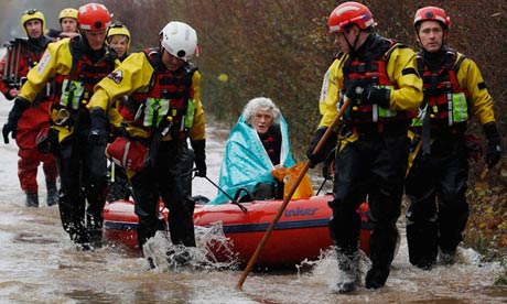
    Last month was the 333rd consecutive month that global temperatures were above the 20th century average, and 2012 will almost certainly be the hottest ever recorded in the US. Hurricanes, heatwaves, wildfires and droughts blistered farmlands and ruined crops from Kansas to Assam, and Britain has had its wettest summer and driest spring to date. Nigeria, China and much of India and Australia have all had their worst floods in decades. In September the Arctic sea ice cover shrank 50% below the 1979-2000 average.

    In a world where climate extremes come faster than ever, the World Bank has found common ground with Greenpeace. Last week, even as the World Meteorological Organisation reported that the amount of greenhouse gases in the atmosphere had reached a record 394ppm, the bank warned that the world is on course for a 4C temperature rise which will consign most people to a very different and much less liveable world, and which will inevitably wreck economies and hopes of development.

    The UN, too, estimated greenhouse gas emissions to be 14% above where they need to be to hold temperatures to a manageable 2C rise. The biggest corporations, including oil companies like Shell, want governments to introduce a carbon price and to seriously address climate change. Even Saudi Arabia and the oil exporters of Opec are considering levying a carbon tax to give to the UN fund that helps poor countries adapt to climate change.

    Evidence of global warming mounts both on the ground and in science, but in the bubble world of international climate diplomacy, little happens. Countries have become less and less able to collectively address the crisis unfolding around them. When UN talks fell apart in Copenhagen in 2009, world leaders claimed they could cobble together a new binding agreement to cut emissions within six months. That became a year, then two years, and now the rich countries tell a bemused public that it will be 2015 at the earliest before a final agreement will be reached. Trillions of dollars can be found to bail out banks in a few months, but the world’s most experienced negotiators cannot find a way to get Americans, the British or anyone to just turn down the air conditioning or lag their roofs to reduce the amount of energy they use.

    So what is the point of the massive UN climate talks which start on Mondaytoday in Doha, one of the most energy-profligate cities on Earth? Negotiators from 194 countries are meeting in an atmosphere of mutual mistrust. They are divided and frustrated, and know their political masters mostly seek only painfully slow progress. We already know rich countries will refuse to commit to any further cuts in emissions or to provide more money, just as we know the poor will try to cling to the few global climate agreements reached between nations years ago. There will be fights, tantrums, and righteous anger from the non-government observers and world media.

    The blame for this miserable state of diplomatic affairs must be laid squarely on the US in particular and the rich countries in general. For three years now, they have bullied the poor into accepting a new agreement. They have delayed making commitments, withheld money and played a cynical game of power politics to avoid their legal obligations. The resulting distrust has fatally plagued the talks.

    In 2009 the rich countries agreed to give $100bn by 2020 to help poor countries adapt to climate change. So far, they have not even provided the $30bn they promised as a down payment. Instead, they have offered less than the annual bonuses given in the City of London – and most of that in the form of loans, not grants. Led by the US, the rich have now wrecked the Kyoto treaty, the one international agreement that legally binds the rich to making cuts, and now it appears they want to ditch the Bali action plan, which commits the US and other countries to reduce emissions. Meanwhile Europe, after three years, still will not say what cuts it is willing to commit to even though the first phase of Kyoto expires in a few months and there is nothing in its place .

    The time for such cynicism and parsimonious diplomacy must be over. Obama, trailing victory, missed the chance to lead the world at Copenhagen but can nowcommit the rich world to a generous agreement. Britain, who will send two ministers to Doha, can lead Europe. A new Chinese administration can be flexible.

    The science and evidence of climate change is clearer than ever, the poor countries on the frontline of the immense changes taking place have done everything that was asked of them by the rich to cut their emissions. In short, there is little time left and no more excuses

  • Rain pours down on saturated Britain

    Rain pours down on saturated Britain

    Further wet weather over the next few days may be followed by snow and ice in the north and east at the weekend

    Diana Mallows, 90, rescued from flooding near Taunton

    Rescued from the rain: Diana Mallows, 90, had been stranded due to flooding at her home at North Curry near Taunton for four days. Photograph: Luke Macgregor/Reuters

    The misery continued for thousands of householders and travellers as torrential rain once again pounded down on parts of the UK this weekend. More wet weather is on the way, but the Met Office says it may be replaced by a fresh hazard – ice and snow – later in the week.

    Up to 60mm of rain is expected, much of it falling on ground already flooded after days of atrocious weather across southern England, the Midlands and Wales. Alerts were in place at notorious flood-risk hotspots including Tewkesbury in Gloucestershire and Upton upon Severn and Evesham in Worcestershire. Eight flood warnings were in place for the River Avon in the Midlands and four for the River Severn.

    The Environment Agency believes around 400 properties in England and Wales have been flooded so far. It has sent out warnings to 9,000 homes and businesses. In all, 44 warnings (indicating flooding is expected) and 155 alerts (warning that flooding is possible) were in place as darkness fell on Saturday.

    In Hertfordshire, police were searching for a man who is believed to have fallen into a canal in Watford after getting separated from his friends in fog. The 50-year-old was walking along a towpath in the early hours of Saturday. Fire crews searched the waist-deep canal but could find no sign of him.

    An elderly man feared drowned in the River Thames at Sonning in Berkshire remains missing.

    The south west of England and parts of south-east Wales were bearing the brunt of the rain on Saturday night and Sunday morning. Eddy Carroll, the Met Office’s chief forecaster, said: “The current very unsettled run of weather is set to continue, with further spells of wet and windy weather expected across the country over the next few days. Further rain moving in from the west on Sunday continues the risk for further flooding and travel disruption.

    “Strong winds may add to the potential for travel disruption, especially across southern Britain. Winds gusting to 50 or 60 mph are expected across southern counties of England with severe gale or possibly storm force winds over the English Channel.”

    The Met Office said it expected the weather to become drier and colder in most areas by the middle of the week, and overnight frost could bring the risk of some icy roads after the recent rain. It said that snow was possible in Scotland and northern and eastern England next weekend.

    So far the only confirmed fatality has been a man who suffered a heart attack after being trapped in his vehicle when it became wedged under a bridge in Chew Stoke, near Bristol, but tales of motorists stranded in the floods continue to emerge.

    Three elderly people were rescued from their car when it was swept down a swollen river near Alcester in Warwickshire on Friday. The silver Vauxhall Corsa was carried for more than 500 metres before a local farmer managed to bring it to the water’s edge, West Midlands ambulance service said. Firefighters using rescue boats pulled the two women and one man out of the windows. They were treated for shock and hypothermia.

    Darron Burness, the AA’s head of special operations, said on Saturday: “With more heavy rain forecast across the Midlands, Wales and the south-west, road conditions in the affected areas are likely to only get worse as the ground is so saturated. Even if you think you know your local roads, don’t be complacent, as flash flooding continues to be a real risk and is catching people out.”

    Work to clear a landslip at Mevagissey harbour in Cornwall has been completed, but the high winds and rain have meant very few fishermen have ventured out. Harbourmaster Hugh Bowles said: “Obviously fishing is completely weather-dependent, so it really does have an impact on fishermen wanting to get out on the water, particularly those with smaller, under-10-metre boats.”

    Devon and Somerset fire and rescue service pumped 1m litres of water from fields below the Grand Western Canal near Tiverton after it burst its banks. Network Rail said trains were likely to be suspended between Exeter and Bristol until Monday because tracks have been flooded.

    John Curtin, head of incident management at the Environment Agency, said: “We would urge people to continue to be prepared for flooding, sign up for Environment Agency flood warnings, keep up to date with the latest situation, and stay away from dangerous floodwater.

    “Our teams have been out around the clock over the last few days to minimise the risks and prepare for flooding, and we are continuing to deploy teams across the country to keep communities safe.”

    It was not only humans who were struggling with the conditions: a one-year-old monkey at the Wild Futures monkey sanctuary near Looe in Cornwall had to be resuscitated after falling ill in the wet weather.

    The sanctuary has been badly hit by the conditions: trees have been brought down by the wind and parts of the centre flooded. The poor summer had already meant the charity was £60,000 worse off than last year. Hayley Dann, its fundraising manager, said: “It has been a really horrible couple of days.”

  • Ocean currents play a role in predicting extent of Arctic sea ice

    Ocean currents play a role in predicting extent of Arctic sea ice

    Posted: 21 Nov 2012 10:08 AM PST

    Researchers have developed a new method to accurately simulate the seasonal extent of Arctic sea ice and the ocean circulation beneath.

  • Fremantle plans for a future of rising sea levels

    Fremantle plans for a future of rising sea levels
    inmycommunity
    IF global warming and climate change cause sea levels to rise by one metre, parts of the West End, North Fremantle and Fishing Boat Harbour will be completely under water, according to the City of Fremantle’s draft Climate Change Adaptation Plan.
    See all stories on this topic »

  • ‘Dark energy’ — Life beneath the seafloor: Scientists present recent findings on the subsurface biosphere

    ScienceDaily: Oceanography News


    What goes down must come back up: Effects of 2010-11 La Niña on global sea level

    Posted: 19 Nov 2012 02:29 PM PST

    In 2010-11, global sea level fell nearly a quarter inch. But, when it comes to long-term sea level, what comes down must eventually come back up.

    ‘Dark energy’ — Life beneath the seafloor: Scientists present recent findings on the subsurface biosphere

    Posted: 19 Nov 2012 01:34 PM PST

    Scientists affiliated with the National Science Foundation (NSF) Center for Dark Energy Biosphere Investigations (C-DEBI) will discuss recent progress in understanding life beneath the seafloor at the American Geophysical Union (AGU) fall meeting, held in San Francisco from Dec. 3-7, 2012. Once considered a barren plain dotted with hydrothermal vents, the seafloor and the crust beneath it are humming with microbial life — with “dark energy”. Once considered a barren plain dotted with hydrothermal vents, the seafloor and the crust beneath it are humming with microbial life — with “dark energy,”

    New energy technologies promise brighter future

    Posted: 19 Nov 2012 12:13 PM PST

    Creative new technologies could change our sources of energy, change our use of energy, and change our lives.

    Invisibility cloaking to shield floating objects from waves

    Posted: 19 Nov 2012 07:45 AM PST

    A new approach to invisibility cloaking may one day be used at sea to shield floating objects – such as oil rigs and ships – from rough waves. Unlike most other cloaking techniques that rely on transformation optics, this one is based on the influence of the ocean floor’s topography on the various “layers” of ocean water. At the American Physical Society’s (APS) Division of Fluid Dynamics (DFD) meeting, being held November 18-20, 2012, in San Diego, Calif., Reza Alam, assistant professor of mechanical engineering at the University of California, Berkeley, will describe how the variation of density in ocean water can be used to cloak floating objects against incident surface waves.
    You are subscribed to email updates from ScienceDaily: Oceanography News
    To stop receiving these emails, you may unsubscribe now.
    Email delivery powered by Google
    Google Inc., 20 West Kinzie, Chicago IL USA 60610
  • Researchers document world-first fire tornado

    Researchers document world-first fire tornado

    Updated 10 hours 23 minutes ago

    The world’s first confirmed case of a fire tornado has been documented by Canberra researchers, using evidence collected from the devastating 2003 Canberra bushfires.

    Researchers have long speculated about the ability of a fire to produce a tornado, but until now they have not been able to scientifically prove it.

    The study involved collecting a vast quantity of evidence from the Canberra bushfires and has been published in the scientific journal Natural Hazards.

    Lead researcher Rick McRae says the fire tornado formed in the ranges west of Canberra before pushing into the city’s suburbs.

    “The one that we looked at showed that as it approached the edge of Canberra, its basal diameter was nearly half a kilometre, and the damage indicates that the horizontal wind speeds around it were in excess of 250 kilometres per hour,” he said.

    “There is also a vertical wind in it at 150kph.”

    He says tornados are different to the whirls often associated with fires.

    “The fire whirl is attached to the hot ground,” he said.

    “A fire tornado, like a true tornado, is attached to the underside of a thunderstorm.”

    Mr McRae says the study provides crucial information on fire behaviour.

    “Our analysis indicates that the tornado had a rating of at least a two on the enhanced Fujita scale of tornado severity [scale of 0-5, with five being the worst],” he said.

    “It had major effects on the behaviour of the fire on the urban edge and had enough force to remove roofs from houses and to blow cars off the road.

    “It’s given us an ability to recreate the behaviour of this thing and for the science community, document what a fire tornado may actually be.”

    Mr McRae says he hopes the case will help emergency authorities better understand the nature of bushfires.


    Topics:research, science-and-technology, bushfire, fires, disasters-and-accidents, canberra-2600, act, australia

    First posted Mon Nov 19, 2012 6:03pm AEDT