Author: admin

  • Global warming preceded by increasing carbon dioxide concentrations during the last deglaciation

    Global warming preceded by increasing carbon dioxide concentrations during the last deglaciation

    Journal name:
    Nature
    Volume:
    484,
    Pages:
    49–54
    Date published:
    (05 April 2012)
    DOI:
    doi:10.1038/nature10915
    Received
    16 September 2011
    Accepted
    01 February 2012
    Published online
    04 April 2012

    Abstract

    The covariation of carbon dioxide (CO2) concentration and temperature in Antarctic ice-core records suggests a close link between CO2 and climate during the Pleistocene ice ages. The role and relative importance of CO2 in producing these climate changes remains unclear, however, in part because the ice-core deuterium record reflects local rather than global temperature. Here we construct a record of global surface temperature from 80 proxy records and show that temperature is correlated with and generally lags CO2 during the last (that is, the most recent) deglaciation. Differences between the respective temperature changes of the Northern Hemisphere and Southern Hemisphere parallel variations in the strength of the Atlantic meridional overturning circulation recorded in marine sediments. These observations, together with transient global climate model simulations, support the conclusion that an antiphased hemispheric temperature response to ocean circulation changes superimposed on globally in-phase warming driven by increasing CO2 concentrations is an explanation for much of the temperature change at the end of the most recent ice age.

    Figures at a glance

    left

    1. Figure 1: Proxy temperature records.Proxy temperature records.

      a, Location map. CBT, cyclization ratio of branched tetraethers; MBT, methylation index of branched tetraethers; TEX86, tetraether index of tetraethers consisting of 86 carbon atoms; , alkenone unsaturation index. b, Distribution of the records by latitude (grey histogram) and areal fraction of the planet in 5° steps (blue line).

    2. Figure 2: CO2 concentration and temperature.CO2 concentration and temperature.

      a, The global proxy temperature stack (blue) as deviations from the early Holocene (11.5–6.5 kyr ago) mean, an Antarctic ice-core composite temperature record42 (red), and atmospheric CO2 concentration (refs 12, 13; yellow dots). The Holocene, Younger Dryas (YD), Bølling–Allerød (B–A), Oldest Dryas (OD) and Last Glacial Maximum (LGM) intervals are indicated. Error bars, 1σ (Methods); p.p.m.v., parts per million by volume. b, The phasing of CO2 concentration and temperature for the global (grey), Northern Hemisphere (NH; blue) and Southern Hemisphere (SH; red) proxy stacks based on lag correlations from 20–10 kyr ago in 1,000 Monte Carlo simulations (Methods). The mean and 1σ of the histograms are given. CO2 concentration leads the global temperature stack in 90% of the simulations and lags it in 6%.

    3. Figure 3: Global temperature and climate forcings.Global temperature and climate forcings.

      a, Relative sea level26 (diamonds). b, Northern Hemisphere ice-sheet area (line) derived from summing the extents of the Laurentide43, Cordilleran43 and Scandinavian (R. Gyllencreutz and J. Mangerud, personal communication) ice sheets through time. c, Atmospheric CO2 concentration. d, Global proxy temperature stack. e, Modelled global temperature stacks from the ALL (blue), CO2 (red) and ORB (green) simulations. Dashed lines show global mean temperatures in the simulations, using sea surface temperatures over ocean and surface air temperatures over land. f, Insolation forcing for latitudes 65° N (purple) and 65° S (orange) at the local summer solstice, and global mean annual insolation (dashed black)44. Error bars, 1σ.

    4. Figure 4: Hemispheric temperatures.Hemispheric temperatures.

      a, Atmospheric CO2 concentration. b, Northern Hemisphere (blue) and Southern Hemisphere (red) proxy temperature stacks. c, Modelled Northern Hemisphere (blue) and Southern Hemisphere (red) temperature stacks from the ALL simulation. d, Northern Hemisphere minus Southern Hemisphere proxy temperature stacks (dark purple). North Atlantic minus South Atlantic region proxy temperature stacks (light purple). e, Modelled Northern Hemisphere minus Southern Hemisphere temperature stacks in the ALL (blue), CO2 (red) and ORB (green) simulations. f, Modelled AMOC strength in the ALL (blue), CO2 (red) and ORB (green) simulations. g, North Atlantic sediment core OCE326-GGC5 231Pa/230Th (ref. 24). Temperatures are given as deviations from the early Holocene (11.5–6.5 kyr ago) mean. Error bars, 1σ.

    5. Figure 5: Temperature change before increase in CO2 concentration.Temperature change before increase in CO2 concentration.

      a, Linear temperature trends in the proxy records from 21.5–19 kyr ago (red) and 19–17.5 kyr ago (blue) averaged in 10° latitude bins with 1σ uncertainties. b, Proxy temperature stacks for 30° latitude bands with 1σ uncertainties. The stacks have been normalized by the glacial–interglacial (G–IG) range in each time series to facilitate comparison.

    right

    Comments

    1. 2012-04-06 08:45 AM

      Report this comment #41044

      Arno Arrak said:

      When I read about “… potential physical explanations for the correlations between temperature, CO2 concentration and AMOC variability in three transient simulations of the last deglaciation…” I started wondering about the purpose of all this verbiage. Climate simulations as far as I go have been losers and I certainly can’t check any of this stuff myself. After more unnecessary verbiage about “Uncertainty analysis” and “Robustnes of results” I realized it was meant to ease us into a belief that they have discovered something big: carbon dioxide did not follow but preceded end-Pleistocene warming. I never would have guessed it from their graphs. It is clear that this paper, as all others emanating from the climate establishment, takes it for granted that any observed warming is caused by the enhanced greenhouse effect of carbon dioxide and attempts to prove it. There is just this one problem with this assumption: the chief greenhouse gas on earth is not carbon dioxide but water vapor. They both absorb outgoing infrared (long-wave) radiation and it is their combined absorption of radiant energy that causes the atmosphere to get warm. But now consider this: when we don’t change the amount of carbon dioxide in the air we have a stable climate. There are local temperature and humidity variations, to be sure, but long-term drift is absent. What guarantees this? To prevent a long term temperature drift the IR absorption by greenhouse gas concentration that determines IR transmittance of the atmosphere must respond to any such temperature drift. And water vapor is the only greenhouse gas that can easily do that. Starting from this qualitative picture Ferenc Miskolczi brought in radiation theory and showed that for a stable climate to exist the optical thickness of the atmosphere in the infrared had to have a value of 1.86 (15% transmittance). This transmittance is determined by the combined absorption of infrared radiation by all the greenhouse gases present, but the adjustment is maintained by water vapor, the only adjustable greenhouse gas in the lot. The blogosphere was hostile to the idea because it wiped out the sacrosanct Arrhenius law. But Miskolczi went on to test it using NOAA database of weather balloon observations that goes back to 1948. He found that the IR transmittance of the atmosphere had been constant for the previous 61 years as his theory predicted (E&E 21(4):243-262, 2010). During that same period of time the amount of carbon dioxide in air increased by 21.6 percent. This means that the addition of all this carbon dioxide to air had no effect whatsoever upon the absorption of IR by the atmosphere. And no absorption means no greenhouse effect, case closed. This is an empirical observation, not derived from any theory, and it overrides any theoretical calculations that do not agree with it. Specifically, it overrides any calculations based on climate models that use the greenhouse effect to predict warming. In accord with this, a close examination of the temperature history of the last 100 years reveals that there has been no greenhouse warming at all during this entire period. Starting with the twentieth century, the first part of the twentieth century warming started in 1910 and stopped in 1940. There was no corresponding increase of carbon dioxide at the beginning of this warming which means that according to the laws of physics it cannot be greenhouse warming. Bjorn Lomborg attributes this warming to solar influence and I agree with him. There was no warming in the fifties, sixties, and seventies while carbon dioxide relentlessly increased. There is no satisfactory explanation for this lack of warming, only various contorted excuses to explain it away. The true reason for this lack of warming is clear from Miskolczi’s work. There was no warming in the eighties and nineties either according to the satellite temperature measurements. There was only a short spurt of warming between 1998 and 2002 caused by the warm water that the super El Nino of 1998 had carried across the ocean. And there was no warming from that point on to the present while carbon dioxide just kept on going up on its merry way. And if you still think Arctic warming proves the existence of greenhouse warming think again: Arctic warming is not greenhouse warming either and is caused by Atlantic Ocean currents carrying warm Gulf Stream water into the Arctic (E&E 22(8):1067-1083, 2011). Taking all this history and Miskolczi’s theory into account the attempt of this Nature article to explain the end-Pleistocene warming as greenhouse warming is nothing more than hopelessly misguided global warming doctrine


  • Quakes Unfurl Fear Of A Tsunami In Indonesia

    Quakes Unfurl Fear Of A Tsunami In Indonesia

    COURTESY  OF DR JOHN JAMES

    By Marianne de Nazareth

    15 April, 2012
    Countercurrents.org

    We watched vicariously on TV, the events unfold on our screen, like we were physically present during the Indonesian earthquake on the 11th April 2012.

    “ In a few minutes it will strike the Indonesian coast,” said the BBC reporter and we stared fascinated as the images of people racing out of buildings and rushing to higher ground showed on the screen. Was Chennai going to be hit as well with a Tsunami like 2004, and Sri Lanka as well we wondered? Thoughts of friends and loved ones flashed through our minds. Then Bangalore rumbled,and our house as well and we realised how strong the quake had been. It was a powerful quake, measuring 8.6 on the richter scale and Tsunami watches were issued across the Indian Ocean. However, it was a relief that no damaging tsunami materialised from the tremor or any of its large aftershocks. How and why did that happen was my question and it was interesting to learn how our planet and its plates that we are perched on works, from the experts.
    In response to my email query, the global forum of seismologists sent me their comments. British Geological Survey seismologist Dr Susanne Sargeant said, this was because the earthquake was the result of horizontal movement on a strike-slip fault, rather than a vertical displacement of the sea floor. She also sent me an expert commentary from the global network of Science Media Centres, to explain the occurrence and to provide background and context to the situation.

    Dr Sargeant, who is a Seismologist & NERC Knowledge Exchange Fellow, British Geological Survey, said:

    “Critical information that is required to assess the potential for a tsunami is the location, magnitude, depth and faulting mechanism. Tsunamis are caused when vertical displacement of the seafloor occurs. In the case of the 11 April earthquake, an earthquake of this magnitude (8.7 Mw) has the potential to generate an ocean-wide tsunami. However, although the earthquake is relatively shallow and offshore, the data indicate that the earthquake was the result of movement on a strike-slip fault. Strike slip earthquakes are caused when two blocks move horizontally past each other. Such an earthquake would not lead to the vertical displacement of the sea floor that would be required to generate a tsunami. Consequently, the potential for a large tsunami from this earthquake is likely to be low.

    “The Sunda trench region is highly active. Earthquakes here are related to subduction of the Indian plate beneath Eurasia. Today’s earthquake occurred on a structure related to the subduction that is occurring here. The tectonics of the region are complex and large earthquakes are relatively frequent. The aftershock sequence has started and this includes an earthquake of magnitude 8.3.

    “Although large, the 08:38 UTC earthquake is located approximately 400 km from the coast of Banda Aceh. As such, the potential for significant damage caused by ground shaking is likely to be relatively low although the actual impact of the earthquake in this region has yet to be confirmed.”

    Professor Kevin Furlong from Pennsylvania State University is currently in the US and is working with the US Geological Survey on this disaster. He has just returned from a sabbatical as the Visiting Erskine Fellow at the University of Canterbury (where he experienced first-hand the Canterbury Quakes) and had this to say:

    “The 11 April 2012, Mw 8.7 earthquake west of Banda Aceh, Sumatra, Indonesia is a very large earthquake within the Indo-Australian plate. Although it is within the plate, its occurrence is almost certainly linked to the plate interactions between Indo-Australian plate and Indonesia (part of the Sunda segment of the Eurasian plate). This earthquake reflects a style of faulting (strike-slip) which involves principally horizontal motion, and thus is unlikely to generate a significant tsunami; although very strong ground shaking would be felt on Sumatra. This is also an extremely large magnitude earthquake for this style of faulting, meaning that it likely involved substantial fault movement, and the fault likely extends for 200+ km.

    “This earthquake is of the same style of faulting and in approximately the same location as an Mw 7.2 earthquake on January 10, 2012. Although this earthquake was within the Indo-Australian plate, any earthquake of this size will change the stress regimes acting on the nearby plate boundaries. The result is that stress conditions on the subduction plate boundary beneath Sumatra have changed, although the implications of that change are uncertain.”

    Adjunct professor at CQ University Kevin McCue, who is President of the Australian Earthquake Engineering Society and Director of the Australian Seismological Centre added to the discussion and said, “According to the USGS website the magnitude 8.7 earthquake occurred well offshore, at least 300 km west of Sumatra so the damage onshore on Sumatra is likely to be minimal. The magnitude may well be decrease to 8.5 or 8.4 after more analysis. The epicentre is well west of the plate boundary and in the Indian Ocean, a fracture along the hinge where the subducting slab of oceanic crust starts bending downward and under Sumatra. The mechanism seems to have been predominantly strike-slip i.e. no substantial vertical displacement of the sea floor so any tsunami would be small and local.”

    Dr Bruce D. Malamud, Reader of Natural and Environmental Hazards, Department of Geography, King’s College London, revealed the type of aftershocks Indonesia is expected to experience in the future. He said that when an earthquake occurs, it releases stress that has built up over time, along a fault. However, in addition to releasing stress, it redistributes the stress along that fault, and sometimes these will be redistributed to other nearby faults. In the case of the 11 April 2012 earthquake that occurred off the west coast of Northern Sumatra, the preliminary estimate of magnitude by the USGS is M8.6, and hundreds of km of fault may have been affected. With the redistribution of stress, aftershocks occur, for weeks, to months (and sometimes years) after the main shock. The magnitude 8.6 earthquake will result in aftershocks occurring all along the fault on which the original earthquake occurred. Some scientists say that one can expect aftershocks as much as 1 unit less than the original shock. So in this case, aftershocks of all sizes can be expected, and if as big as a magnitude of about 7.6, it could potentially trigger a tsunami.

    The instability caused by the quake, in the area said Malamud, can cause aftershocks, so the problem has not gone away. In response Malmud said that after an earthquake occurs along a fault, stress is released in parts. But then, part of this stress is redistributed to other parts of the fault. This means that they are now more likely to become unstable, with many subsequent earthquakes. Aftershocks can continue for weeks and months after the main shock which is the biggest earthquake in the sequence, sometimes even years.

    In response to the question if earthquakes have been more frequent over the last century and are they increasing, Malamud said, “ Let’s take as a ‘large’ earthquake one with moment magnitude 7. The number of earthquakes per year with moment magnitude greater than or equal to 7 varies certainly, year to year, but the average from 1900 to present is about 17 magnitude 7 or greater earthquakes per year (compared to about 1 magnitude 8 or greater earthquake). If we just look at 1990 to 2010, then the average was about 15 magnitude 7 or greater earthquakes per year. And if we look at the last three years, then the average is also 15 of this size earthquake per year. So, no, the actual number of very large earthquakes is not increasing over time. It fluctuates year to year, with some years less and some years more.”

    And if you would like to know how much energy is released in a magnitude 7 earthquake and a 9 earthquake, Malamud revealed, the equivalent to the energy released in half a megaton nuclear bomb, is the quantum released for a 7 earthquake. And for a 9, the equivalent of 1000 times the energy released in a magnitude 7 earthquake, or one thousand half-megaton nuclear bombs. If we convert this to energy, this would be roughly enough to power every home in the USA for 50 days.

    Although scientists have been trying for many years to predict earthquakes (the when and how big), they so far have not succeeded, but are still working at it, says Malamud. “For a complete prediction, we need to tell people when a disaster will occur, where, and how big. As scientists, we have a good idea of where large events might occur based on written and instrumental records of past events. So for instance, we know that Indonesia is near subduction zones, and that there is an extensive history of earthquakes in the past, so we know that Indonesia is likely to experience earthquakes. Based on these past records, we can also forecast the chance that a given size or larger earthquake might occur, in a given year. This is called probabilistic hazard forecasting, and has been very useful in telling us about how big we might expect, on average, each year. But true prediction is much more difficult, where we tell people that ‘next week there will be an earthquake of magnitude of 9′.

    Tad Murty, who is adjunct Professor in the Department of Civil Engineering, University of Ottawa, Canada said: “If there is a large earthquake far from the ocean, on land, there is no tsunami. The earthquake itself needs to be shallow – some 20 or 30 km below the ocean bottom before it can generate a tsunami, and it needs to be a dip slip, like a subduction. The movement needs to be vertical, not horizontal. In today’s earthquake in Indonesia, the movement was horizontal, because the Indian plate slid past the Burmese plate. In 2004, the Indian Plate went under the Burmese plate, and tens of cubic kilometres of water were suddenly displaced and piled at the ocean surface. This is what causes a tsunami.

    Dr Bruce D. Malamud, of Kings College also explained how early warning systems work and said, that there are many different kinds of detectors, and one can never depend on just one set of detectors. First, the earthquake itself has to be detected. This is done by seismographs, and these are done, mostly on land. Earthquake waves propagate through the interior of Earth’s crust, as well as earth’s surface.

    We also have ocean-bottom pressure sensors. There are several dozen all around the ocean. They are the first indicators of a tsunami. Then we have tidal gauges, on land but on the coast, put in the water, and they catch the tsunami coming in. By then it’s usually too late.

    Indonesia has an early warning system. But all the international agencies work together. They are all part of the Intergovernmental Oceanographic Commission, and that’s all coordinated by UNESCO.”

    In response to the question on whether any changes have been effected in the tsunami warning system since the disaster in 2004, he said, “Following the disaster in 2004, the first early warning systems were placed in the Indian Ocean. With each disaster we learn new things. On the scientific side, we already know the physical principles but we fine-tune our computer models and we make our instruments more precise. The physical process is the same. On the social and economic side, there has been progress, for example, with evacuations.

    “When a cyclone hits in the area, almost all the damage and loss of life comes from the storm surge. In developing countries like India and Bangladesh, they use a ‘vertical evacuation system’. Because you can’t evacuate millions of people from the area, the infrastructure and the roads just aren’t there. So they built cyclone shelters on the coast, that are well built and can withstand storm surges and cyclones. In the US, they use a ‘horizontal evacuation system’, because the highways are good and the roads are there so people just move away from the coast.

    “In the 2004 tsunami, none of the cyclone shelters in India were damaged. So they thought maybe they could use them for tsunamis as well. Now, if there has to be an evacuation for a tsunami, they use the cyclone shelters.”

    The US Geological Survey said the first 8.6-magnitude quake was centred 20 miles beneath the ocean floor around 270 miles from Aceh province. That prompted the Pacific Tsunami Warning Centre in Hawaii to issue a tsunami watch for Indonesia, India, Sri Lanka, Australia, Burma, Thailand, the Maldives and other Indian Ocean islands, Malaysia, Pakistan, Somalia, Oman, Iran, Bangladesh, Kenya, South Africa and Singapore.

    (The writer is a registered PhD scholar and adjunct faculty, St. Joseph’s College, Bangalore)

    *with inputs sent by British Geological Survey seismologist Dr Susanne Sargeant


  • The glaciers are still shrinking – and rapidly

    The glaciers are still shrinking – and rapidly

    A couple of glaciers shrinking more slowly than expected does not change the irrefutable fact that most are melting rapidly

    • guardian.co.uk, Sunday 15 April 2012 18.00 BST
    • Article history
    • Himalayas glaciers : The Sun Breaks Over the Summit of Gasherbrum IV

      Daybreak over Gasherbrum IV on the Baltoro glacier in the Karakoram range of the Himalayas. Photograph: Ed Darack/Corbis

      Glaciers are one of the natural environments most often used to illustrate the impacts of climate change. It is fairly indisputable that in a warming world, glaciers melt faster. Yet two recent studies published in top scientific journals (more here and here) suggest that in the Himalayas the rate of mass loss has been small and overestimated, and that further west, in the Karakoram range, the glaciers are actually slightly gaining mass.

      Is there a conflict between these studies and the wider body of research indicating that, worldwide, glaciers have been receding for several decades?

      To answer this question, we need to look a little more carefully at what the studies show, and to place them in the context of global changes to land and sea ice. Both studies cover a relatively short period of time: eight to nine years, over roughly the last decade. The Himalayas experience large variations in snowfall from year to year depending on the strength of the monsoon. But in atmospheric sciences, trends in climate are generally determined from records that span at least 30.

      To obtain observations over these longer time scales is a challenging task for glaciologists. There are more than 160,000 glaciers on the planet, less than 120 of which have continuous, long-term measurements taken. These ground-based measurements have been supplemented by data from airborne and satellite sensors. The combined records indicate that most, but not all, glacier systems have been losing mass for at least the last four decades, and that the rate of loss has been accelerating since the 1990s for key regions including Patagonia, the Canadian Arctic, Alaska and, most important of all for sea-level rise, from the great ice sheets covering Antarctica and Greenland.

      These two ice giants contain 99.5% of all land ice on Earth, and store enough ice to raise global sea level by around 64 metres. The evidence that mass loss in Greenland and west Antarctica has been accelerating since the early 1990s is irrefutable.

      Likewise, Arctic sea ice that used to cover around 9m sq km of ocean at the end of summer has, after 30 years, reduced at such a rate that the Arctic Ocean seems likely to be ice-free in summer by the middle of this century. The most recent predictions for the European Alps, for which there are comprehensive observations, suggest that glaciers will have shrunk in area by 80-96% by 2100.

      With glaciers and ice sheets covering such a diverse range of latitudes (from the tropics to the poles) and altitudes (from sea level to over 6,000 metres), it is not surprising that there are regional variations in their behaviour. Such variability should not, however, distract from the broader and more important story unfolding, which is one of profound and likely irreversible changes to global land and sea ice cover. Taken as a whole, the evidence for sustained changes to the cryosphere is clear.

      The impacts these changes are having on water resources, sea-level rise and climate feedbacks are already observable and significant. Some recent predictions of the increase in sea levels by 2100 exceed one metre. Loss of Arctic sea ice results in enhanced warming of the Arctic Ocean due to a strong positive feedback.

      Most glaciologists believe we are witnessing unprecedented changes to land and sea ice. The burning question is not if, but how fast, land and sea ice will disappear, and what we can do to mitigate and adapt to these changes.

      • Prof Jonathan Bamber is director of the Bristol Glaciology Centre

    A couple of glaciers shrinking more slowly than expected does not change the irrefutable fact that most are melting rapidly

  • Five killed by 120 twisters in US mid-west


    Five killed by twisters in US mid-west

    Updated: 06:30, Monday April 16, 2012

    Five people have been killed after a tornado ripped through a small town in Oklahoma, where many residents were caught unaware because storm sirens failed to sound.

    The tornado was one of some 120 twisters reported over the weekend so far in America’s Midwest.

    Woodward, in the northwest of Oklahoma, was badly damaged in the twister, which struck after midnight, local time.

    Reports said two children were among the dead, and one person injured in the storm is believed to be in a critical condition.

    The town’s mayor, Roscoe Hill, said the tornado hit a mixed area of homes and businesses.

    He added it appeared that sirens to warn people of the approaching danger had not worked – even though they had been sounding loudly from storms on Saturday afternoon.

    ‘We had a little tornado earlier… and they blew all the sirens. When this one came in, our sirens weren’t working,’ Mr Hill said.

    The National Weather Service (NWS) said there had been some 120 tornado sightings in four US states – Oklahoma, Kansas, Nebraska and Iowa.

    Most were recorded in Kansas, where almost 100 twisters were spotted – including a half-mile-wide tornado close to Wichita.

    While no injuries or deaths were reported in the town, an Air Force base and a mobile home park were badly damaged.

    In the state’s central-north, a tornado touched down near Tipton, taking tin off a building.

    Elsewhere in Oklahoma, one twister hit Mustang, a suburb of Oklahoma City, before dawn.

    There was major roof damage to at least one home, while trees, power lines and fences were down.

    Tornadoes also briefly struck on Saturday afternoon in Nebraska’s Nuckolls County and Thayer County, but no major damage was immediately reported.

    SHARE THIS ARTICLE:

  • What would 3 degrees mean

    01 September 2010

    What would 3 degrees mean?

    David Spratt

    The failure of international climate negotiations means that if all countries acted on ALL their commitments, the world would still warm by more than 3 degrees, according to Climate Tracker.

    So what would a world 3 degrees warmer llok and feel like? Scientists draw on a number of disciplines and methods to answer the question, including paleo-climatology (study of past climate history), complex mathematical models of the world’s climate system tested and refined against past climate data, observation of current events and specific research testing hypotheses. Mark Lynas surveyed much of this research for his book “Six degrees: our place on a hotter planet” (Harper Collins, 2007). Drawing from his work and other sources, the following is an overview of some of the scientific projections as the world warms. These are not all certain events, but they are what scientific research thinks is likely. A full set of references on pp. 301-327 of “Six Degrees”.

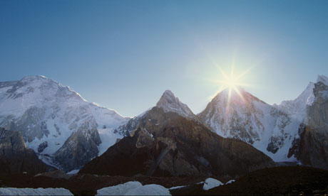
    Three degrees of warming

    Three degrees may be the “tipping point” where global warming could run out of control, leaving us powerless to intervene as planetary temperatures soar. America’s most eminent climate scientist, James Hansen says warming has brought us to the “precipice of a great “tipping point”. If we go over the edge, it will be a transition to “a different planet”, an environment far outside the range that has been experienced by humanity. There will be no return within the lifetime of any generation that can be imagined, and the trip will exterminate a large fraction of species on the planet” [“Wild” magazine, April 2007].

    In the Pliocene, three million years, temperatures were 3 degrees higher than our pre-industrial levels, so it gives us an insight into the three-degree world. The northern hemisphere was free of glaciers and icesheets, beech trees grew in the Transantarctic mountains, sea levels were 25 metres higher [Climate Dynamics, 26, 249-365], and atmospherc carbon dioxide levels were 360-400 ppm, very similar to today. There are also strong indications that during the Pliocene, permanent El Nino conditions prevailed. Hansen says that rapid warming today is already heating up the western Pacific Ocean, a basis for a coming period of ‘super El Ninos’ [Proc. Nat. Acad. Sci., 103, 39, 14288-93].

    Between two and three degrees the Amazon rainforest, whose plants produce 10 per cent of the world’s photosynthesis and have no evolved resistance to fire, may turn to savannah, as drought and mega-fires first destroy the rainforest, turning trees back into carbon dioxide as they burn or rot and decompose [Theor. App. Climatology, 78, 137-56]. The carbon released by the forests destruction will be joined by still more from the world’s soils (see below), together boosting global temperatures by a further 1.5ºC [Nature, 408, 184-7]. It is suggested than in human terms the effect on the planet will be like cutting off oxygen during an asthma attack. A March 2007 conference at Oxford talked about ‘corridors of probability’ with models predicting the risk of the Amazon passing a “tipping point” at between 10 to 40 per cent over the next few decades. The UK’s Hadley Centre climate change model, best known for warning of catastrophic losses of Amazon forest, predicts that, under current levels of greenhouse gas emissions, the chances of such a drought would rise from 5% now (one every 20 years) to 50% by 2030, and to 90% by 2100.

    The collapse of the Amazon is part of the reversal of the carbon cycle projected to happen around 3 degrees, a view confirmed by a range of researchers using carbon coupled climate models. Vast amounts of dead vegetation stored in the soil – more than double the entire carbon content of the atmosphere – will be broken down by bacteria as soil warms. The generally accepted estimate is that the soil carbon reservoir contains some 1600 gigatonnes, more than double the entire carbon content of the atmosphere. The conversion will begin of the terestrial carbon sink to a carbon source due to temperature-enhanced soil and plant respiration overcoming CO2-enhanced photosynthesis, resulting in widespread desertification and enhanced feedback [Physics Today, www.aip.org/pt/vol-55/iss-8/p30.html].

    And it’s already happening. A recent study found that the calculated increase in carbon lost by UK soil each year since 1978 is more than the entire reduction in emissions the UK has achieved between 1990 and 2002 as part of its commitment to Kyoto. As well, some recent studies suggest that the earth’s carbon sinks are smaller than expected and climate by century’s end could be on average up to 1.5 degrees hotter than current “business as usual” projections suggest [http://www.csmonitor.com/2007/0503/p01s02-wogi.html]. New research published in “Science” in May 2007 suggests that the earth’s ability to soak up the gases causing global warming is beginning to fail because of rising temperatures, in a long-feared sign of “positive feedback” (Michael McCarthy, The Independent, 18 May 2007).

    Three degrees would likely see increasing areas of the planet being rendered essentially uninhabitable by drought and heat. Rainfall in Mexico and central America is projected to fall 50 per central. Southern Africa would be exposed to perennial drought, a huge expanse centred on Botswana could see a remobilisation of old sand dunes [Nature, 435, 1218-21], much as is projected to happen earlier in the US west. The Rockies would be snowless and the Colorado river will fail half the time. Drought intensity in Australia could triple, according to the CSIRO, which also predicts days in NSW above 35 degrees will increase 2 to 7 times.

    With extreme weather continuing to bite – hurricanes may increase in power by half a category above today’s top-level Category Five – world food supplies will be critically endangered. This could mean hundreds of millions – or even billions – of refugees moving out from areas of famine and drought in the sub-tropics towards the mid-latitudes. As the Himalayan ice sheet relentlessly melts with rising temperatures, the long-term water flows into Asia’s great rivers and breadbasket valleys — the Indus, Ganges and Brahmaputra, the Mekong, Yangtse and Yellow rivers — will fall dramatically. If global temperatures rise by three degrees, and that’s becoming the un-official target for western governments, water flow in the Indus is predicted to drop by 90 per cent by 2100. The lives of two billion people are at stake.

    As the Arctic continue to warm, melting permafrost in the boreal forests and further north in the Arctic tundra is now starting to melt, triggering the release of methane, a greenhouse gas twenty times more powerful than CO2, from thick layers of thawing peat. The West Siberian bog is estimated to contain 70 billion tonnes of CO2. Prof. Sergei Kirpotin, a botanist at Russia’s Tomsk State University, says: “There’s a critical barrier… Once global warming pushes the melting process past that line, it begins to perpetuate itself.” The West Antarctic ice sheet would likely to irreversibly melting

    Two degrees of warming

    With two degrees of warming, the summer monsoons in northern China will likely fail, and agricultural production will fall in India’s north as forest die back and national production falls. Flooding in Bangladesh will worsen as its monsoons strengthen [Climate Dynamics, 22, 183-204] and sea levels rise. But in the Andes, glacial loss will reach 40-60% by 2050 [Journal of Hydrology, 282, 1, 130-44], reducing summer run-off and subsequent water shortages will be devastating for nations such as Peru. At two degrees, snowpack decline in California will be one-third to three-quarters [Proc. Nat. Academy Sciences, 101, 34, 12422-7] and in the Northern Rockies from 20-70% [Climatic Change, 62, 75-113] , devastating agriculture as the water run-off declines. Changing climate will have a severe impact on world food supplies. While the Great Plains turn to dust, winter wheat will be able to to grow in central-north USA, but soybean and sorghum production in the south-east USA will halve. In central and south America maize losses are projected for all nations but two [Global Env. Change, 13, 51-9]. In 29 African countries, including Mali, Botswana and Congo, crop failure and hunger are likely to increase.

    With two degrees of warming, seas will be on their way to rising 5 to 7 metres; the irreversible melting of the Greenland ice sheet will be underway [Climatic Change, 64, 61-75]. Greenland’s critical melt threshold is regional temperature rise of 2.7 degrees [Nature, 428, 616], but with its temperatures at least 2.2 times the global average [Geophysical Research Letters, 32, L14705], that point will have been triggered at just over a one degree global rise. Rising Arctic temperatures flowing from floating ice loss are already at the threshold beyond which glaciologists think the Greenland ice sheet may be doomed; this accelerated melting is caused by meltwater penetrating crevasses and lubricating the glaciers’ flow. The ice is in effect sliding into the ocean on rivers of water, an effect not included in models of the effect of global warming on the Arctic (New Scientist 25 February 2006]. Greenland’s ice loss rate increased 250% between 2002-04 and 2004-06 [Nature, 443, 330-1], suggesting it may already be too late with a global warming of 0.8 degrees to 2006. The polar bear would be all but extinct; walruses not far behind. The tundra would be almost gone, replaced by forests as the permaforst boundary retreats hundreds of kilometres north. With a five-metre sea level rise, Miami would disappear, as would most of Manhattan. Central London would be flooded, and Bangkok, Bombay and Shanghai would lose most of their area.

    With two degrees of warming, Europe likely will be hit every second year by heatwaves like the one in 2003 which killed 22-35,000 people, caused $12b of crop losses, reduced glacier mass by 10%, and resulted in a 30% drop in plant growth dropped, adding half a billion tonnes of carbon to the atmosphere [Geophysical Research Letters, 32, L22709]. April 2007 was UK’s warmest April since records began in 1659 [The Guardian, 2 May 2007]. Concurrently Italy’s government was facing power cuts following the mildest winter since records began, with rivers and lakes in the worst-affected north of the country have never been drier. It is being taken as the latest sign that Italy could find itself on the frontline of the global warming war [BBC News, 26 April 2007]. The Mediteranean will be subject to drought as rainfall drops 20%, and wildfires.

    As more carbon dioxide dissolves in seawater to form carbonic acid, the acidity of the ocean increases. With two degrees of warming, increasing uptake of CO2 by large areas of the southern oceans and parts of the Pacific will have increased their acidity by 2050 such that the seas become toxic to organisms with calcium carbonate shells, for the simple reason that the acidic seawater will dissolve them. Many species of plankton – the basis of the marine food chain and essential for the sustenance of higher creatures, from mackerel to baleen whales – will be wiped out. Pteropods, as important as krill in some areas of the oceans, will lose their soft shells and die en masse, as will urchins and coral [Nature, 437, 681-6]. CO2 emissions, if unabated, could cause a mass extinction of marine life (NASA 20 February 2006) similar to one that occurred 65 million years ago when the dinosaurs disappeared: CO2 levels are going up extremely rapidly, overwhelming our marine systems (Washington Post, July 5, 2006)

    One degree of warming

    With one degree of warming, the Amazon will likely be affected by regular drought: in 2005 such an event meant some tributaries ran dry [Reuters, 11 Oct 2005] and in 1989 forest fires in a drying Amazon poured 0.4 billion tonnes of carbon into the air, more than five per cent of global greenhouse gas emissions for the year. The Amazon is near critical threshold [Phil Trans Royal Soc London B, 359, 539-47].

    With one degree of warming, California and the Great Plains states of Nebraska, Montana, Wyoming, Arizona, northern Texas and Oklamhoma will be subject to mega-droughts and desertification, a new and permanent “dust bowl”. During the 1000-1300 AD “Medieval Warm Period” devastating epic droughts [Nature, 384, 552-4] hit the Great Plains, whole native American populations collapsed; in the Holocene maximum 6000 years ago, when temperatures were similar to today, heatwaves seared the western half on continent with 40 per cent less rain than today, sustained over decades [Climatic Change, 63, 49-90].

    With one degree of warming, the north Queensland rainforest, very sensitive to temperature rises, will be an “environmental catastrophe” waiting to happen [Proc Royal Soc London B, 270, 1887-92]. Just one degree is likely to reduce Queensland highland rainforest by half [Austral Ecology, 26, 590-603]. The Barrier Reef is already subject to regular bleaching; in 2002, 60-95 per cent of reefs surveyed were bleached, and the reef is now doomed [Age, 30 January 2007]. Bleaching will become more severe and coral reefs will be close to extinction at 2 degrees [Jones & Preston, Climate change impacts, risk and the benefits of mitigation, CSIRO 2006].

    With one degree of warming, world cyclones will likely be more severe; small islands states will be abandoned as seas rise (it’s already happening). Ice sheets around the world be suffering severe losses: landslides in the European Alps are already serious as permafrost melts and retreats upwards; the Kilamanjoro ice sheet which has been intact for at least 11,000 years is on the way to disappearing. 80 per cent has been lost in the last 100 years [Science, 298. 589-93] and the rest will be gone by 2015-2020, bringing forest loss to the surrounding area.

    With less than one degree of warming, Arctic ground frozen by permafrost for 3000 years is melting [Geophysical Research Letters, 33, L02503], and the floating ice that covers the north pole is disappearing fast, likely to be gone within three decades; it has passed a crucial tipping point of irreversible climate change [Science, 310, 627-8]. Winter sea ice in the Arctic has failed to reform fully for the third year in a row, and the Arctic’s ice cover is retreating more rapidly than estimated by any of the 18 computer models used by the 2007 IPCC assessments; the shrinking of summertime ice is about 30 years ahead of the climate model projections [Geophysical Research Letters online edition 1 May 2007]. The Arctic may be free of all summer ice as early as 2030, a positive feedback loop with dramatic implications for the entire Arctic region [BBC News, 12 Dec 2006]. With no ice, the Arctic region will rapidly begin heating, by as much as 12 degrees, putting further pressure on the Greenland icecap [Age, 28 October 2006]. Greenland’s irreversible melting will result in a sea rise of five to seven metres, in as little as a hundred years [Environ. Res. Lett., 2, 024002,]. 125,000 years ago during the Eemian period, seas were 5-6 metres higher than today, at temperatures 1-2 higher than pre-industrial levels [Science, 311, 1747-50].

    British researchers calculated that an increase of just one degree of warming would eliminate fresh water from a third of the world’s land surface by 2100. The 2006 Conference of the International Association of Hydrogeologists concluded that rising sea levels will also lead to the inundation by salt water of the aquifers used by cities such as Shanghai, Manila, Jakarta, Bangkok, Kolkata, Mumbai, Karachi, Lagos, Buenos Aires and Lima. Within the next few decades rising sea levels will pollute underground water reserves with salt. Long before the rising tides flood coastal cities, salt water will invade the porous rocks that hold fresh water. The problem will be compounded by sinking water tables due to low rainfall and rising water usage by the world’s growing and increasingly urbanised population [New Scientist 16 April 2006].

    Four + degrees of warming

    Four degrees
    • Hundreds of billions of tonnes of carbon locked up in Arctic permafrost – particularly in Siberia – enter the melt zone, releasing globally warming methane and carbon dioxide in immense quantities.
    • The West Antarctic ice sheet may lift loose from its bedrock and collapse as warming ocean waters nibble away at its base, much of which is anchored below current sea levels.
    • In Europe, new deserts will be spreading in Italy, Spain, Greece and Turkey: the Sahara will have effectively leapt the Straits of Gibraltar. In Switzerland, summer temperatures may hit 48C, more reminiscent of Baghdad than Basel. The Alps will be so denuded of snow and ice that they resemble the rocky moonscapes of today’s High Atlas – glaciers will only persist on the highest peaks such as Mont Blanc. The sort of climate experienced today in Marrakech will be experienced in southern England, with summer temperatures in the home counties reaching a searing 45C. Europe’s population may be forced into a “great trek” north.

    Five degrees
    • Five degrees of warming occured during the Eocene, 55 million years ago: breadfruit trees grew on the coast of Greenland, while the Arctic Ocean saw water temperatures of 20C within 200km of the North Pole itself. There was no ice at either pole; forests were probably growing in central Antarctica.
    • The Eocene greenhouse event was likely caused by methane hydrates (an ice-like combination of methane and water) bursting into the atmosphere from the seabed in an immense “ocean burp”, sparking a surge in global temperatures. Today vast amounts of these same methane hydrates still sit on subsea continental shelves.
    • The early Eocene greenhouse took at least 10,000 years to come about. Today we could accomplish the same feat in less than a century.

    Six degrees
    • At the end of the Permian period, 251 million years ago, up to 95% of species were extinct as a result of a super-greenhouse event, resulting in a temperatures rise by six degrees, perhaps because of an even bigger methane belch than happened 200 million years later in the Eocene.
    • One scientific paper investigating “kill mechanisms” during the end-Permian suggests that methane hydrate explosions “could destroy terrestrial life almost entirely”. Acting much like today’s fuel-air explosives (or “vacuum bombs”), major oceanic methane eruptions could release energy equivalent to 10,000 times the world’s stockpile of nuclear weapons.

  • The voter’s challenge

    Compulsory voting in Australia helps build on our national cynicism, providing a healthy acceptance that the government might be a bunch of ratbags, but they are our ratbags.

    The combination of compulsory and preferential voting means that, at least half of us put them higher on our voting ticket than any other bunch of sods. At some level, we said, “Go on, you have a go, you mug. See if you can run the place.”

    The 2012 Queensland election result is an interesting case in point. Remember that 90% of the seats have gone to the conservative side of politics and that The Greens have none. Well may Barnaby note that the wheels have fallen of the ALP jalopy.

    Loss of faith

    I spent the Queensland election day on a booth, handing out how to vote cards, chatting to the other booth workers and talking to voters.

    Most voters are there under sufferance. Most voters believe that the fundamental problem with politics is the stupidity of politicians. If they would simply get on with managing the day to day affairs of state there would be no mess for us to get out of.

    The ALP fundamentally understood this after the heady Whitlam years, moved the economy to the core of its management policy and has thus successfully shared government with the conservatives for the last 25 years.

    The program was initiated by Neville Wran in NSW and brought to national fruition by Hawke and Keating. Internationally it was adopted by Blair in England and Clinton in the US. Keating mastered the art of selling to the electorate the globalisation of the economy and the economic rationalisation of social welfare to the electorate and the trade union movement.

    The medium term impact was to make Australia internationally competitive and a global trader of more significance than its population size would indicate.

    The long term impact has been the de-unionising and hence casualisation of the workforce. The very cosy relationship with the top end of town has shifted large volumes of wealth from the public to the private sector. Most alarmingly, this includes the demutualisation of our insurance and superannuation sectors.

    Having unleashed the genie that bought their soul, those once great social democratic institutions now founder. as genie calls in the favours.

    Wayne Swan’s very public, but incredibly narrow, attack on the mega-rich was a callous and calculated attempt to publicly bite the hand that deals out the dog food.

    Over the last six years Queensland Labor has lost 350,000 voters. The LNP has gained 360,000 and Katter’s Australian has gained 250,000. There are 200,000 new voters in Queensland now compared to 2006. The swing of 19% in this election campaign is more extreme than the 16% seen in NSW in 2011 or the 6% swing seen in Victoria in 2010 – both of which saw a change in government. The variations in the Greens and independent vote account for the difference.

    We might estimate, then, that the anger at Labor is such that about 10% of the electorate who would not normally swing at the end of an electoral cycle is rejecting them as a government. This is consistent with the 230,000 additional people who changed sides compared with the 150,000 who changed sides between 2006 and 2009. Not only are these people angry, the fact that 250,000 went to Katter rather than the LNP shows that those people are not angry with Labor, they are angry with the status quo in politics. It is their story that must dominate any analysis of the political landscape in Queensland.

    Deep divisions

    One phenomenon raised around the world by commentators in many different fields is the increasing degree of separation between the progressive and conservative elements of society. Social mobility and increased choice in communication and consumption of information means that we can live in suburbs, visit doctors, employ tradespeople, watch television stations and engage in public entertainment with people who largely reflect our attitudes.

    The simplification of politics to slogans, the hostility with which people deride “the other” are an outcrop of this phenomenon and it is accelerated by the militarisation of Hollywood and the political end-game around oil.

    While that is a global phenomenon and requires philosophical analysis to be fully understood its impact can be seen on the ground in Queensland.

    Bob Katter’s Australian Party has taken up the arms of One Nation following the very clever manipulation of Pauline Hanson by John Howard and the ensuing integration of the national and liberal parties in Queensland. The fiercely independent, mostly rural folk, who do not like big government and want to have sensible local control of the basics of life without too much philosophy, diplomacy or international interference have been political pawns of the right and are now keen to play their own game.

    They are the redneck donk, the 182cubic inch Holden red motor, under the bonnet of the Liberal Party. These are the voters who respond to the three word slogans of Stop the Boats, No New Tax etc.

    Once again, they have their own party which will influence the government on those issues where it can afford to be flexible. Where it cannot, such as when it comes to Coal Seam Gas, the government will desert its rural cousins as it has always done, “in the greater interest”.

    One quarter of a million people – 11.5% of Queensland voters – put Katter’s Australian Party first on their ballot.

    That is a far better indicator of the nature of the frustration in the electorate.

    This is lower than the 400,000 Nationals vote in 2006, the last Qld election in which it was a party in its own right. The Nationals then fielded almost as many votes as the Liberals – 392,000 to 442,000.

    It does not include many of the Family First vote which was 40,000 in 2006, 20,000 in 2009 and 32,000 in 2012. It does include most of the 10,000 One Nation voters from 2006 of whom only 2,000 remain.

    This means that 240,000 Katter voters have presumably peeled off the flanks of the 1 million strong rural Nationals. Even without the many frustrated rural Laborites this 240,000 is much less dramatic than the Democratic Labor Party split in 1955 or the creation of the Country Party by old-man Page in 1920. It is more reminiscent of the creation of the Democrats, the Australia Party or One Nation.

    The passion they bring to the electoral process and the response of the electorate to a seriously underfunded grass-roots campaign is the stuff of Green Dreams.

    Limp Greens?

    Given the ubiquity of Green philosophy in political slogans, magazine articles, corporate vision statements and so on, it seems counter-intuitive that The Greens have not been able to convert large numbers of voters to their cause.

    The numbers in the previous three Queensland elections tell the story.

    In 2006 the Green vote across Queensland was 180,000, around eight percent, in 2009 that climbed to 200,000 topping nine percent, this most recent election it is back to 180,000 which is now a little under the eight percent of six years ago.

    A seat by seat analysis confirms that the trend is general. In Mount Cootha where the party thought it had the best chance and put large numbers of people on the ground to run an effective, modern political campaign, the result was …

    All the commentators, looking at these figures, conclude that the Green march forward is in abeyance. The Greens seem to have hit the traditional plateau of the third party in Australian politics. The expectation is that they will stay there until they unravel or are kicked out by the next big thing.

    If the Greens are to, as they have done in Germany, northern NSW and the inner-city suburbs of Sydney and Melbourne, reach the magic one quarter of the vote and lead a progressive partnership with the Labour movement, they have to break through this nexus, cleanly and soon.

    The Queensland results show how hungry the electorate is for something different to believe in. The Greens need to fire up the little Green donkey and unleash the inner Green dragon. St Bob’s resignation creates an ideal opportunity for this.

    The intense hatred felt toward the present Greens by Katter’s adherents is an important part of this analysis, that will be dealt with next.