Author: Neville

  • Earth matters Hindustan Times

    Earth matters
    Hindustan Times
    New Delhi, May 28, 2013
    First Published: 16:51 IST(28/5/2013)
    Last Updated: 17:53 IST(28/5/2013)

    Rolling in the deep: A geologist is a scientist who studies the solid and liquid matter that constitutes the earth as well as the processes and history that has shaped it

    The lowdown Geology is the study of the earth and its processes. This discipline includes geophysics, atmospheric science, oceanography, hydrogeology (concerned with distribution and movement of groundwater in the earth’s crust), palaeontology (study of fossils, origin of

    life), physics of the earth, crystallography, geoexploration, geostatistics, geomaths, geochemistry, economic geology, environmental geology, remote sensing and GIS, among others. Earth scientists work in the Geological Survey of India, Central Ground Water Board, Indian Bureau of Mines, Directorate General of Hydrocarbons, government mining departments (directorates of mines and geology), mining companies, oil exploration companies such as ONGC, Schlumberger, Oil India, gas exploration companies like Reliance, Hindustan Zinc Ltd, Goa-based National Institute of Oceanography, Central Road Research Institute and other research organisations. Teaching and research in universities and colleges is an option for the academically inclined.Clockwork
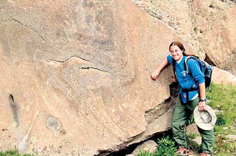
    The average workday of a Geological Survey of India geologist away in the field (which could be a jungle, a mountain, a ravine, or a plain), where he stays in a camp for three-four months:
    7.30am: Set out for field work. Collect rock, soil and water samples and data. Carry out field mapping
    5pm: Return to camp before sunset
    Till 9pm: Organise the samples. Process the data. Plot the data on a map. Send data to the headquarters, where other geologists analyse and study the samples, write reports and take care of administrative tasks

    The payoff
    The median salary of a geologist with an MSc degree is Rs. 5 lakh per annum. The average salary of a geologist with MSc degree varies from area to area and is dependent on a person’s knowledge. Starting from a meagre Rs. 25,000 to Rs. 27,000 a month for a fresh geologist in a small private mining company in a remote location, he/she can fetch Rs. 1.5 lakh a month as starting salary in an international oil and gas company (if posted on off-shore oil rigs, he might earn US$200 to 300 per day as additional perks)

    Skills/TRAITS
    * Interest in science, including biology
    * Good physique and stamina to work in the field
    * Persistence
    * Deep understanding of nature and natural phenomena

    Getting there
    Take science (with maths) at the plus-two level. Go for a bachelor’s degree, followed by a master’s degree. A doctorate is required for (university) research positions

    Institutes and URLs
    * University of Delhi,  www.du.ac.in
    * Aligarh Muslim University, www.amu.ac.in
    * Banaras Hindu University, www.bhu.ac.in
    * Indian School of Mines, Dhanbad, www.ismdhanbad.ac.in
    * Bangalore University,       www.bangaloreuniversity.ac.in
    * Jadavpur University, Kolkata, www.jadavpur.edu
    * Presidency University, Kolkata, www.presiuniv.ac.in/presidency/apply
    * Department of Geology & Geophysics, Indian Institute of Technology Kharagpur www.iitkgp.ac.in
    * University of Calcutta, Kolkata, www.caluniv.ac.in
    * Centre for Earth Sciences, Indian Institute of Science, Bangalore www.ceas.iisc.ernet.in
    * Department of Geology, University of Pune           www.unipune.ac.in/dept/science/geology/default.htm

    Pros and cons
    * Work and research opportunities abound both in India and abroad
    * Scope for new discoveries
    * You can visit unusual places
    * Work may involve travel and even staying in camps
    * Most jobs are available only after MSc programme
    * Geology is a low-key discipline that not many students hanker after

    Geology is fascinating in addition to opening a multitude of career opportunities, it profoundly alters one’s worldview, enabling one to appreciate movements of very large parts of the earth’s crust —- Mallickarjun Joshi, professor, department of geology, Banaras Hindu University

  • Scientists Develop CO2 Sequestration Technique

    Scientists Develop CO2 Sequestration Technique

    May 28, 2013 — Lawrence Livermore scientists have discovered and demonstrated a new technique to remove and store atmospheric carbon dioxide while generating carbon-negative hydrogen and producing alkalinity, which can be used to offset ocean acidification.


    Share This:

    The team demonstrated, at a laboratory scale, a system that uses the acidity normally produced in saline water electrolysis to accelerate silicate mineral dissolution while producing hydrogen fuel and other gases. The resulting electrolyte solution was shown to be significantly elevated in hydroxide concentration that in turn proved strongly absorptive and retentive of atmospheric CO2.

    Further, the researchers suggest that the carbonate and bicarbonate produced in the process could be used to mitigate ongoing ocean acidification, similar to how an Alka Seltzer neutralizes excess acid in the stomach.

    “We not only found a way to remove and store carbon dioxide from the atmosphere while producing valuable H2, we also suggest that we can help save marine ecosystems with this new technique,” said Greg Rau, an LLNL visiting scientist, senior scientist at UC Santa Cruz and lead author of a paper appearing this week (May 27) in the Proceedings of the National Academy of Sciences. When carbon dioxide is released into the atmosphere, a significant fraction is passively taken up by the ocean forming carbonic acid that makes the ocean more acidic. This acidification has been shown to be harmful to many species of marine life, especially corals and shellfish. By the middle of this century, the globe will likely warm by at least 2 degrees Celsius and the oceans will experience a more than 60 percent increase in acidity relative to pre-industrial levels. The alkaline solution generated by the new process could be added to the ocean to help neutralize this acid and help offset its effects on marine biota. However, further research is needed, the authors said.

    “When powered by renewable electricity and consuming globally abundant minerals and saline solutions, such systems at scale might provide a relatively efficient, high-capacity means to consume and store excess atmospheric CO2 as environmentally beneficial seawater bicarbonate or carbonate,” Rau said. “But the process also would produce a carbon-negative ‘super green’ fuel or chemical feedstock in the form of hydrogen.”

    Most previously described chemical methods of atmospheric carbon dioxide capture and storage are costly, using thermal/mechanical procedures to concentrate molecular CO2 from the air while recycling reagents, a process that is cumbersome, inefficient and expensive.

    “Our process avoids most of these issues by not requiring CO2 to be concentrated from air and stored in a molecular form, pointing the way to more cost-effective, environmentally beneficial, and safer air CO2 management with added benefits of renewable hydrogen fuel production and ocean alkalinity addition,” Rau said.

    The team concluded that further research is needed to determine optimum designs and operating procedures, cost-effectiveness, and the net environmental impact/benefit of electrochemically mediated air CO2 capture and H2 production using base minerals.

    Other Livermore researchers include Susan Carroll, William Bourcier, Michael Singleton, Megan Smith and Roger Aines.

    Share this story on Facebook, Twitter, and Google:
  • The Critical Decade: Climate science, risks and responses

    The Critical Decade: Climate science, risks and responses

    Download full report: The Critical Decade: Climate science, risks and responses

    Over many decades thousands of scientists have painted an unambiguous picture: the global climate is changing and humanity is almost surely the primary cause. The risks have never been clearer and the case for action has never been more urgent.

    Our Earth’s surface is warming rapidly and we can already see social, economic and environmental impacts in Australia.

    Failing to take sufficient action today entails potentially huge risks to our economy, society and way of life into the future.

    This is the critical decade for action.

    The Critical Decade: key messages

    The Critical Decade: full report

    Find out more

    Author:
    Tags: , , , , , , , , , ,

    Related content

    « Back to Reports

    Subscribe to our newsletter

    RSS

    Did you know?

    The effects of climate change has serious consequences for human health.

    Video

    Climate Change Fuelling Wilder Weather

  • Climate Researchers Discover New Rhythm for El Niño

    Climate Researchers Discover New Rhythm for El Niño

    May 27, 2013 — El Niño wreaks havoc across the globe, shifting weather patterns that spawn droughts in some regions and floods in others. The impacts of this tropical Pacific climate phenomenon are well known and documented.


    Share This:

    A mystery, however, has remained despite decades of research: Why does El Niño always peak around Christmas and end quickly by February to April?

    Now there is an answer: An unusual wind pattern that straddles the equatorial Pacific during strong El Niño events and swings back and forth with a period of 15 months explains El Niño’s close ties to the annual cycle. This finding is reported in the May 26, 2013, online issue of Nature Geoscience by scientists from the University of Hawai’i at Manoa Meteorology Department and International Pacific Research Center.

    “This atmospheric pattern peaks in February and triggers some of the well-known El Niño impacts, such as droughts in the Philippines and across Micronesia and heavy rainfall over French Polynesia,” says lead author Malte Stuecker.

    When anomalous trade winds shift south they can terminate an El Niño by generating eastward propagating equatorial Kelvin waves that eventually resume upwelling of cold water in the eastern equatorial Pacific. This wind shift is part of the larger, unusual atmospheric pattern accompanying El Niño events, in which a high-pressure system hovers over the Philippines and the major rain band of the South Pacific rapidly shifts equatorward.

    With the help of numerical atmospheric models, the scientists discovered that this unusual pattern originates from an interaction between El Niño and the seasonal evolution of temperatures in the western tropical Pacific warm pool.

    “Not all El Niño events are accompanied by this unusual wind pattern” notes Malte Stuecker, “but once El Niño conditions reach a certain threshold amplitude during the right time of the year, it is like a jack-in-the-box whose lid pops open.”

    A study of the evolution of the anomalous wind pattern in the model reveals a rhythm of about 15 months accompanying strong El Niño events, which is considerably faster than the three- to five-year timetable for El Niño events, but slower than the annual cycle.

    “This type of variability is known in physics as a combination tone,” says Fei-Fei Jin, professor of Meteorology and co-author of the study. Combination tones have been known for more than three centuries. They where discovered by violin builder Tartini, who realized that our ear can create a third tone, even though only two tones are played on a violin.

    “The unusual wind pattern straddling the equator during an El Niño is such a combination tone between El Niño events and the seasonal march of the sun across the equator” says co-author Axel Timmermann, climate scientist at the International Pacific Research Center and professor at the Department of Oceanography, University of Hawai’i. He adds, “It turns out that many climate models have difficulties creating the correct combination tone, which is likely to impact their ability to simulate and predict El Niño events and their global impacts.”

    The scientists are convinced that a better representation of the 15-month tropical Pacific wind pattern in climate models will improve El Niño forecasts. Moreover, they say the latest climate model projections suggest that El Niño events will be accompanied more often by this combination tone wind pattern, which will also change the characteristics of future El Niño rainfall patterns.

    Share this story on Facebook, Twitter, and Google:

    Other social bookmarking and sharing tools:


    Story Source:

    The above story is reprinted from materials provided by University of Hawaii ‑ SOEST, via EurekAlert!, a service of AAAS.

    Note: Materials may be edited for content and length. For further information, please contact the source cited above.


    Journal Reference:

    1. Malte F. Stuecker, Axel Timmermann, Fei-Fei Jin, Shayne McGregor, Hong-Li Ren. A combination mode of the annual cycle and the El Niño/Southern Oscillation. Nature Geoscience, 2013; DOI: 10.1038/ngeo1826

    APA

    MLA

    University of Hawaii ‑ SOEST (2013, May 27). Climate researchers discover new rhythm for El Niño. ScienceDaily. Retrieved May 28, 2013, from http://www.sciencedaily.com­ /releases/2013/05/130527100628.htm?utm_source=feedburner&utm_medium=email&utm_campaign=Feed%3A+sciencedaily%2Fearth_climate%2Fsevere_weather+%28ScienceDaily%3A+Earth+%26+Climate+News+–+Severe+Weather%29

    Note: If no author is given, the source is cited instead.

  • New South Wales Climate change impacts in NSW.

    <!– –>

    New South Wales Climate change impacts in NSW.

    Potential impacts and costs

    Around 7.2 million people, 32 per cent of Australia’s population, live in NSW. With large population centres clustered along the coastline and important agricultural and tourism industries in regional centres, NSW is highly vulnerable to a changing climate.

    The following information highlights some of the potential impacts and costs to the state’s industries, infrastructure, environment and people from climate change.

    Coastal zone

    Between 43,900 and 65,300 residential buildings, with a current value of between $14 billion and $20 billion may be at risk of inundation from a sea level rise of 1.1 metres. A 1.1 metre sea level rise will also put at risk up to 4,800 km of NSW roads, up to 320 km of NSW railways, and up to 1200 commercial buildings. These assets have an estimated value of up to $10.4 billion, $1.3 billion and $9 billion respectively.

    Local government areas of Lake Macquarie, Wyong, Gosford, Wollongong, Shoalhaven and Rockdale represent over 50 per cent of the residential buildings at risk in NSW.

    Global sea levels increased by 1.7 millimetres per year over the 20th century. Over the past 15 years, this trend has increased to approximately 3.2 millimetres per year. This rate varies significantly around Australia. Since the early 1990s, NSW has experienced sea level rise of approximately 2.1 millimetres per year.

    In 2009, the Australian Government produced the report, Climate Change Risks to Australia’s Coasts, followed in 2011 by an update to this report entitled Climate Change Risks to Coastal Buildings and Infrastructure. For a visualisation of the potential sea level rise, the department has also produced a series of maps available at www.ozcoasts.org.au.

    Water supply

    Modelling for the Sydney Water Balance Project has found that there may be a decrease in annual rainfall and runoff in the inland catchments and minor increases in the coastal catchments by 2030. Climate change is also likely to result in an increase in evaporation throughout the catchments, with the Sydney Water Balance Project predicting up to a 22 per cent increase in pan-evaporation in inland catchments and a 9 per cent increase in coastal catchments by 2070.

    Extreme events

    In Sydney extreme heat days of over 35 degrees Celsius are likely to increase from 3.5 days per year currently experienced to up to 12 days by 2070 without global action to reduce emissions.

    Climate change is also expected to contribute to an increase in the number of extreme bushfire days in parts of NSW. In the Sydney region the number of extreme fire danger days could rise from the current 9 days per year to as many as 15 in 2050. Research suggests that by 2020 fire seasons will start earlier and end slightly later, while being generally more intense throughout their length, with these changes becoming more pronounced by 2050.

    An increase in mean temperatures and a decrease in rainfall and relative humidity will likely amplify the fire danger in south eastern forests, with increased fire frequency and extent of area burned.

    Human health

    As the number of days above 35 degrees Celsius increases and heatwaves become more frequent, more people are likely to suffer heat-related illnesses and death, with the elderly particularly vulnerable. An estimated 176 people aged 65 and over die each year in Sydney from heat-related deaths (1997-1999 average). This could potentially rise to 417 people a year by 2020 and up to 1312 by 2050.

    The population of NSW is more susceptible to cold-related deaths than heat-related deaths. As such, the total temperature-related deaths are projected to be up to 1,906 in 2100 with no mitigation, compared to 2754 in a world with no human-induced climate change.

    Mosquito-borne diseases, such as dengue and Murray Valley Encephalitis, can lead to serious and sometimes life-threatening illnesses. Under moderately warmer and wetter climate conditions, there may be an increase in the prevalence of some mosquito-borne diseases in some parts of NSW.

    Other climate change related health risks relevant to NSW include the impact of severe weather events including bushfires, food-borne infectious diseases, increases in air pollution and mental health consequences. The adverse health impacts of climate change will be greatest among people on lower incomes, the elderly and the sick.

    Natural environments

    The Australian Alps, which are home to vulnerable alpine flora and fauna, are highly susceptible to warming. Under an extreme emissions scenario with increased warming and decreased rainfall, the length of the snow season may decrease by up to 96 per cent by 2050. Species such as the Mountain Pygmy Possum that occupy habitat at the highest elevations and in the coldest environments will have nowhere to retreat as the climate warms. A 1 degree Celsius temperature rise could dramatically decrease the entire climatic habitat of the Mountain Pygmy Possum.

    It is predicted that climate change could impact on Lord Howe Island by increasing the altitude of the cloud layer through rising sea surface temperatures. This would constitute a major climate related threat to the plant communities of Lord Howe Island. This cloud layer provides a source of precipitation and maintains the humidity required by about 86 per cent of the island’s endemic plant species, including the dwarf mossy forest that dominates the summit of the peaks on the Island. Seabirds may also be at risk from changes in the abundance and distribution of marine food caused by climate change in combination with other threats, such as intensive fishing activities.

    In the greater Blue Mountains region of NSW, more variable rainfall, drought and strong winds, in combination with highly flammable vegetation are likely to create ideal conditions for extreme and more frequent fire behaviour. Many eucalypt species require fire-free periods of six years or more to ensure their survival and as such changed forest fire regimes may result in the irreversible loss of some species and have severe impacts for fauna throughout the region.

    Agriculture

    Agriculture plays an important role in the NSW economy. Potential changes in climate may reduce productivity and output in agricultural industries in the medium to long term through higher temperatures, reduced rainfall and extreme weather events.

    The gross value of NSW agriculture production in 2009-10 was $8.4 billion. ABARE modelling in 2007 estimates the following declines in agricultural production for NSW compared to a compared to a world with no human-induced climate change.

    Approximate decline in production by 2030 and 2050
    Approximate decline in production by 2030 (%) Approximate decline in production by 2050 (%)
    Wheat 8.4 11.6
    Beef 0.7 3.0
    Sheep meat 8.1 13.2
    Dairy 5.5 11.3

    Adaptation

    Given the state’s high vulnerability to projected climate change, it is important that appropriate actions are taken by government, businesses, communities and individuals to ensure effective adaptation is possible in a changing environment.


  • Northern Territory Climate change impacts in the NT.

    Northern Territory Climate change impacts in the NT.

    Potential impacts and costs

    The Northern Territory is the least populous of Australia’s states and territories, home to 1 per cent of Australia’s population. Of the 230,000 people living in the NT, the majority of people live in Darwin. There are numerous remote settlements and approximately 31 per cent of all Indigenous Australians live in the Northern Territory.

    The Northern Territory has two distinct climate zones. The Top End, including Darwin, has a tropical climate with high humidity and two seasons, the wet season (November to April) and the dry season (May to October). By contrast, the central region of the Territory, including Alice Springs and the Uluru National Park, is semi-arid.

    Projected changes in climate conditions may affect natural systems and human settlements in the NT. The following information highlights potential impacts and costs to the Northern Territory’s industries, environment and people from climate change.

    Coastal zone

    Climate change will lead to sea level rise and potentially greater storm surges which will impact on coastal settlements, infrastructure and ecosystems. Between 260 and 370 residential buildings, with a current value of between $100 million and $134 million may be at risk of inundation from a sea level rise of 1.1 metres. A 1.1 metre sea level rise will also put 2045 kilometres of the NT’s roads, up to 24 commercial buildings and 32km of railways at risk. These assets have an estimated value of up to $1.8 billion, $500 million and $100 million respectively.

    Darwin is particularly vulnerable to riverine flooding and more intense cyclonic activity. Impacts on infrastructure are expected to be extreme under a ‘business as usual’ climate scenario, including major threats to vital port infrastructure on the NT coast.

    Global sea levels increased by 1.7 millimetres per year over the 20th century. Over the past 15 years, this trend has increased to approximately 3.2 millimetres per year. This rate varies significantly around Australia. Since the early 1990s northern Australia has experienced increases of up to 7.1 millimetres per year.

    In 2009, the Australian Government produced the report Climate Change Risks to Australia’s Coasts, followed in 2011 by an update to this report entitled Climate Change Risks to Coastal Buildings and Infrastructure. These reports provide information on sea level rise in Australia.

    Extreme events

    In Darwin the number of days over 35 degrees Celsius is expected to increase from 11 per year currently experienced to up to 69 by 2030 and up to 308 by 2070 without global action to reduce emissions. Coupled with the extremely high humidity that Darwin experiences during the wet season, higher temperatures are expected to adversely affect levels of human comfort.

    In Alice Springs, the number of hot days over 35 degrees Celsius is expected to increase from 90 per year currently experienced to up to 182 by 2070 without global action to reduce emissions.

    Projections indicate there may be an increase in the proportion of tropical cyclones in the more intense categories, with a decrease in the total number of cyclones. For example, the number of category 3 to 5 cyclones is projected to increase, and by 2030 there may be a 60 per cent increase in intensity of the most severe storms, and a 140 per cent increase by 2070.

    Human health

    It is predicted that without mitigation there may be as many as 407 temperature-related deaths in the NT by 2100 compared to 61 in a world with no human induced climate change. In Darwin, an estimated 2 people aged over 65 years die each year from heat-related deaths (1997-1999 average). This could potentially rise to between 37 and 126 each year by 2050.

    The NT is also highly receptive to the establishment of mosquito-borne diseases such as dengue, which can lead to serious and sometimes life-threatening illnesses. Under moderately warmer and wetter climate conditions, combined with changes in water storage practices such as an increase in the establishment of water tanks under increasing drought conditions, there may be an increase in the prevalence of some mosquito-borne diseases in some parts of the NT.

    Warmer temperatures and increased rainfall variation may also increase the occurrence of food and water-borne diseases.

    Natural environments

    Tourism is a major industry and employment sector for the NT and is largely focused on the natural environments. In 2010, 1.3 million people visited the NT and spent over $1.4 billion. Tourism is estimated to contribute around 10 per cent to the NT economy.

    Some of the most visited iconic sites, such as the Kakadu National Park, are under threat from the impacts of climate change.

    In 2011, the Australian Government released the report Kakadu: Vulnerability to Climate Change Impacts which outlines the impacts of climate change to this important area.

    The lowland parts of Kakadu are vulnerable to changed salinity as a result of sea level rise and saline intrusion into groundwater. Current projections are that sea level around Kakadu will rise by at least 8 centimetres and by up to 30 centimetres by 2030.

    Rising sea levels will have severe impacts given the wetland system of Kakadu is contingent on a delicately balanced interaction between its freshwater and marine environments. Fundamental changes in ecological function of the national park will place severe pressure on many species of both plants and animals.

    Salt water intrusion into the Kakadu wetlands over the past 50 years has resulted in the tidal range of creeks moving four kilometres inland in the East Alligator River catchment, and significantly increased the area of bare and saline mudflats, killing two-thirds of the Melaleuca forest.

    Melaleuca swamp forests are important roosting habitats for many waterbirds, and are also utilised by aquatic fauna for spawning. A decrease in this habitat will have negative impacts on such species.

    Agriculture

    Climate change is likely to put at risk agricultural production, particularly beef production in the NT. The NT had an estimated meat cattle population of around 1.7 million in 2009. Potential changes in the climate could reduce beef production by 19.5 per cent by 2030 and by 33.2 per cent by 2050. Climate change may also exacerbate the impacts of heat stress and cattle ticks on beef production.

    Adaptation

    Given the Northern Territory’s high vulnerability to projected climate change, it is important that appropriate actions are taken by government, businesses, communities and individuals to ensure effective adaptation is possible in a changing environment.