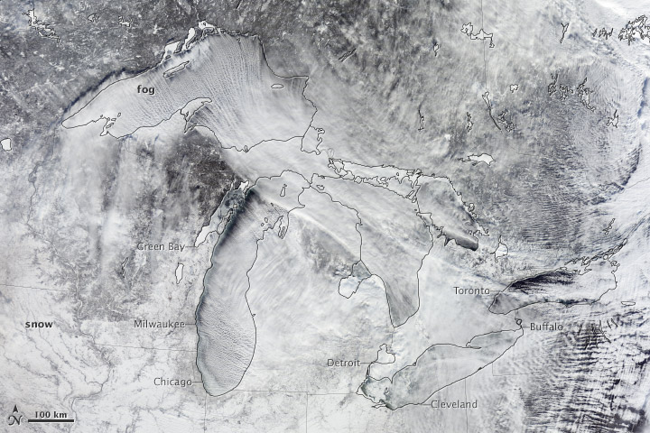

A swirling mass of Arctic air moved south into the continental United States in early January 2014. On January 3, the air mass began breaking off from the polar vortex, a semi-permanent low-pressure system with a center around Canada’s Baffin Island. The frigid air was pushed south into the Great Lakes region by the jet stream, bringing abnormally cold temperatures to many parts of Canada and the central and eastern United States.
When the cold air passed over the relatively warm waters of Lake Michigan and Lake Superior, the contrast in temperatures created a visual spectacle. As cold, dry air moved over the lakes, it mixed with warmer, moister air rising off the lake surfaces, transforming the water vapor into fog—a phenomenon known as steam fog.
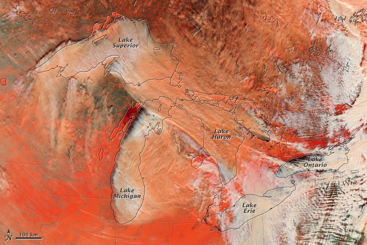
On January 6, 2014, the Moderate Resolution Imaging Spectroradiometer MODIS on NASA’s Terra satellite captured this natural-color image (top) of fog forming over the lakes and streaming southeast with the wind. A false-color image (bottom) produced with data from the same instrument helps illustrate the difference between snow (bright orange), water clouds (white), and mixed clouds (peach). Water clouds are formed entirely by liquid water drops; mixed clouds contain both water droplets and ice crystals.
To see what the steam fog looked like from the ground, view the video clips included as part of this story in the Huffington Post.
-
References
- Weather Underground (2014, January 6) What’s a Polar Vortex?: The Science Behind Arctic Outbreaks. Accessed January 6, 2014.
- NOAA (2014, January 6) Types of Fog. Accessed January 6, 2014.
NASA Earth Observatory images by Jesse Allen and Robert Simmon, using data from LANCE/EOSDIS Rapid Response. Caption by Adam Voiland.
- Instrument:
Leave a Reply
You must be logged in to post a comment.